People ask me two questions about Route 66 more than any others. The first is where it starts. The second is why anyone still cares about a highway that the federal government officially retired in 1985. This article is my answer to the second one.
I drove the whole road end to end in April 2026 while finishing the Field Manual, and the thing that struck me most was how much of its history is still sitting right there on the pavement. You can read the story of the road in its bridges, its gas stations, its motel signs and the towns that were left behind. But you read it better if you know the dates. So here they are, checked against the National Park Service, the Library of Congress, Congress itself and the state archives, and told in order.
Route 66 history in one paragraph
Route 66 was born on paper in 1926, when the United States created its first system of numbered federal highways and gave the number 66 to a road running from Chicago to Los Angeles through eight states. It was fully paved by 1938. In the 1930s it carried families fleeing the Dust Bowl, and John Steinbeck named it the Mother Road in The Grapes of Wrath (1939). During World War II it moved soldiers and freight. After the war it became a vacation road, a song, and later a TV show. The Interstate Highway System, approved in 1956, slowly replaced it. The last town was bypassed in Williams, Arizona, in October 1984, and the highway was removed from the federal system in June 1985. Then a barber in Seligman, Arizona, started a revival that never stopped. On November 11, 2026, the road turns 100.
Before the number: a nation of named trails
In the early 1920s, American highways did not have numbers the way we know them. They had names, and the names belonged to private associations that promoted them, painted colored bands on telephone poles and sometimes routed travelers past the businesses that paid their dues. It was confusing, and the states and the federal government wanted one national system with clear numbers.
That system was being drawn up in 1925 and 1926. One of the routes on the map was a diagonal road from Chicago to Los Angeles. It did not follow a straight line west. It bent southwest through Missouri and Oklahoma before turning west across Texas, New Mexico, Arizona and California. That diagonal is the reason the road would later matter so much to small towns on the Plains. It connected places the older east-west routes had skipped.
When was Route 66 built? The birth in 1926
The short answer is that Route 66 was created in 1926, but it was not built from scratch that year. The new federal highway was stitched together from existing roads, some of them paved, many of them gravel or dirt. What 1926 gave it was a number, a route on the official map and a shield on the signs.
Who built Route 66: Cyrus Avery and the fight over a number
If one person gets credit, it is Cyrus Avery of Tulsa, Oklahoma, who is widely called the Father of Route 66. He was an Oklahoma road booster, and he fought hard for the Chicago to Los Angeles road and for the number it would carry.
The number was a real fight. Avery and his allies originally wanted 60, and the federal planners initially gave it to them. Then Kentucky objected. A compromise offered the number 62, and that did not sit well with Avery or with B. H. Piepmeier of Jefferson City, Missouri, who was working with him on the route. The argument dragged on for about six months.
The Springfield telegram of April 30, 1926
The deadlock broke in Springfield, Missouri. At 4 p.m. on Friday, April 30, 1926, Avery and Piepmeier, who happened to be in town that day, looked over the list of numbers still available and noticed that 66 had not been assigned to anything. They sent a telegram from the Postal Telegraph office in the Colonial Hotel to Washington saying that if the other parties agreed, they would accept 66.
That telegram is why Springfield calls itself the Birthplace of Route 66. If you are going to stop in only one city in Missouri for the history, this is the one, and I cover what is left of that story in my guide to the Missouri stops.
November 11, 1926: the official birthday
The numbered federal highway system, including US 66, was approved on November 11, 1926. That is the date the road treats as its birthday, and it is why the centennial falls on November 11, 2026.
So when someone asks me when Route 66 was built, I give three dates: April 30, 1926, when it got its number; November 11, 1926, when it became official; and 1938, when you could finally drive the whole thing on pavement.
The 1930s: paving the road and the Dust Bowl exodus
Fully paved by 1938
For its first years, long stretches of Route 66 were still gravel, dirt or mud depending on the weather. The Great Depression changed that. According to the National Park Service, from 1933 to 1938 thousands of unemployed young men from nearly every state were put to work on road gangs through New Deal relief programs. Because of that effort, the entire highway from Chicago to Los Angeles had pavement by 1938.
The Dust Bowl and the road west
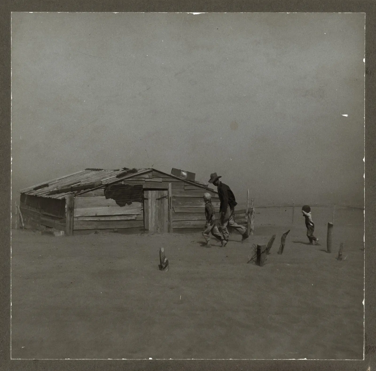
In the same years the road was being paved, drought and dust storms were wrecking farms across the southern Plains. Families packed what they could into cars and trucks and headed west toward California, and for many of them Route 66 was the way out. The National Park Service estimates that about 210,000 people migrated to California to escape the Dust Bowl.
The NPS also notes something that surprised me: by scholarly estimates, only a small share of those Dust Bowl travelers stayed in California for good. The road carried people out, and for many it also carried them back.
Why it's called the Mother Road: Steinbeck and The Grapes of Wrath
In 1939, John Steinbeck published The Grapes of Wrath, a novel about the Joad family, Oklahoma farmers who lose their land and drive west to California. Steinbeck called Highway 66 "the mother road, the road of flight." The National Park Service credits the novel, and the 1940 film made from it, with fixing Route 66 in the American mind.
That is where the nickname "the Mother Road" comes from. It was not a tourism slogan. It came out of a book about poverty, displacement and people refusing to give up. I think that is part of why the name has lasted. When people say "Route 66, the Mother Road," they are, knowingly or not, quoting a story about hard times.
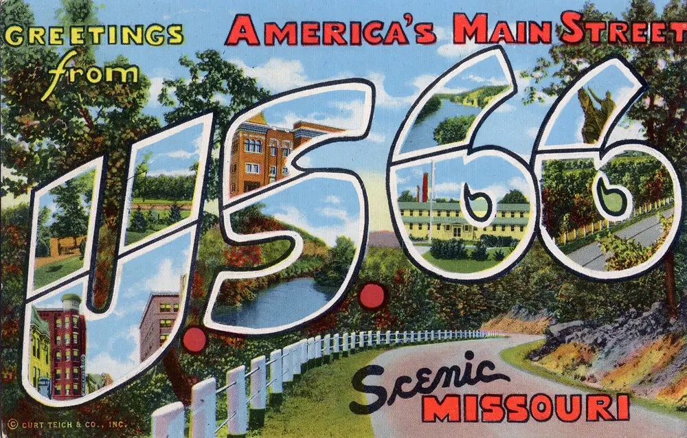
The road picked up a second nickname too. You can see it on postcards from the 1940s: "America's Main Street." It describes the road's other life, as the main street of hundreds of small towns.
World War II: a military road
When the United States entered World War II, the War Department chose the West for many of its training bases, in part because of the open space and the dry weather that suited air and field maneuvers. The National Park Service notes that over $230 million was invested in new military bases in Arizona alone.
Route 66 became one of the corridors that tied those bases, and the war plants on the West Coast, to the rest of the country. According to the NPS, between 1941 and 1943 trucks rather than trains carried at least half of all defense-related material headed to America's war production plants. Convoys, soldiers on leave and workers moving to California for defense jobs all shared the same two-lane road.
1946-1960s: the song, the motels and the TV show
Get your kicks: Bobby Troup and Nat King Cole, 1946
After the war, Americans had cars, savings and paid vacations, and a lot of them pointed those cars west. In 1946 songwriter Bobby Troup wrote "(Get Your Kicks on) Route 66," and Nat King Cole recorded it the same year. The song is basically a list of towns along the road set to a swing beat, and it did more for the highway's fame than any brochure. It has been recorded many times since.
If you want to know why Route 66 is famous and not, say, US 40 or US 30, the song is a big part of the answer. It gave the road a name people could sing.
The motel and neon boom
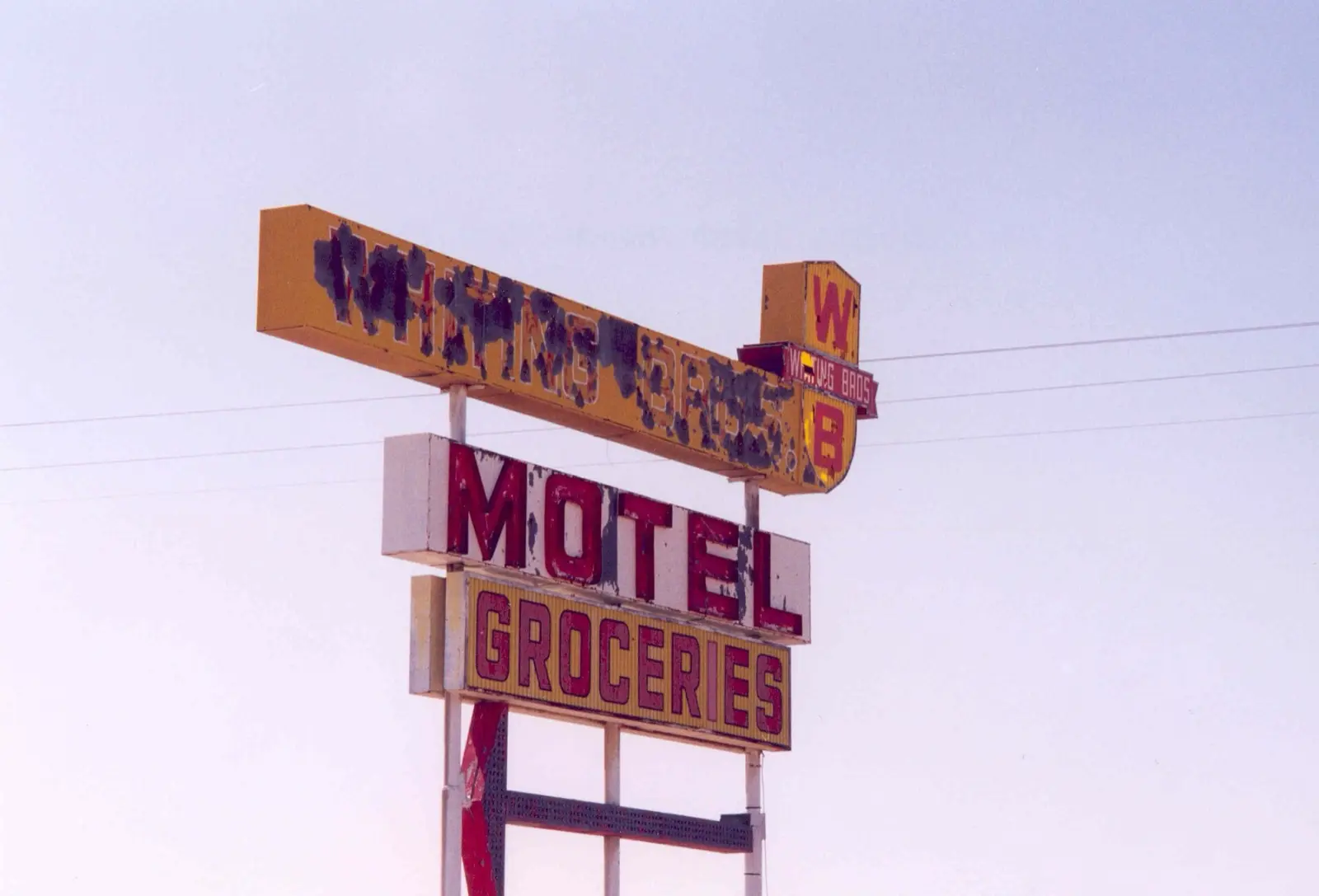
The postwar traffic created the roadside that most people now picture when they think of Route 66: motor courts and motels with neon signs, diners, gas stations, trading posts, and attractions built mainly to get drivers to pull over. Towns that had been farm or railroad stops started earning their living from travelers. A lot of the buildings that survive along the route today date from this period, and some of the motels from those decades are still renting rooms. I keep a list of the ones worth booking in my Route 66 motels guide.
It was not all romance. The two-lane road was crowded and dangerous. Northern Arizona University's library notes that in 1956, one out of every six traffic deaths in Arizona happened on Route 66.
The TV show Route 66 (1960-1964)
From 1960 to 1964, a television series called Route 66 followed two young adventurers cruising the highway in a Chevrolet Corvette. By then the number itself stood for the open road, and a weekly show built on that idea brought it into living rooms across the country.
The interstates and the bypasses
The same safety and capacity problems that made Route 66 crowded made it a target for replacement. In 1956, Congress passed the Federal-Aid Highway Act, which created and funded the Interstate Highway System. Britannica notes that some segments of Route 66 had already been replaced by newer, wider roads even before that law was signed.
Over the next three decades, interstates took over the old corridor piece by piece: I-55 in Illinois, I-44 in Missouri and Oklahoma, I-40 from Oklahoma west across Texas, New Mexico and Arizona, and I-15 in California. Each time a new segment opened, the traffic left the old road and the businesses along it had to cope. Some towns survived as exits. Others did not. If you want to see exactly how the old alignment and the interstate relate today, I lay it out in Route 66 vs I-40.
Williams, Arizona: the last town bypassed (October 13, 1984)
The last piece of Route 66 to be bypassed went through Williams, Arizona. On October 13, 1984, the final stretch of I-40 around the town opened, and a crowd of about 500 people gathered at the new interchange to mark the end of the road. Williams was the last town on the route to lose its through traffic.
Williams did something smart with what it had left. Its downtown kept the old road as its main street, and today it is one of the most rewarding stops in the state. It is in my Arizona stops guide for that reason.
When was Route 66 decommissioned?
On June 27, 1985, the American Association of State Highway and Transportation Officials (AASHTO) voted to remove US 66 from the federal highway system. That is the date usually given for the decommissioning. By then, the old road had already been bypassed along its whole length, so the vote was mostly paperwork. The shields came down, maps stopped showing the number, and the road's sections went back to the states, counties and cities.
What did not happen is just as important. The road was never torn up. Most of it is still there, as state highways, county roads, frontage roads and town main streets, and you can still drive the large majority of it.
The revival: how Route 66 came back
For a few years after 1985 it looked like the story was over. Then the people who lived along the road decided otherwise.
Angel Delgadillo and Seligman, 1987
Seligman, Arizona, lost its through traffic when I-40 bypassed it, and the town suffered for it. Angel Delgadillo, a barber who was born in Seligman and kept his shop on the old road, decided the highway needed to be remembered as a historic road. He called a meeting in Seligman on February 18, 1987, and fifteen people came. That meeting founded the Historic Route 66 Association of Arizona.
The association's first goal was simple: get "Historic Route 66" signs on the old highway. It worked fast. In November 1987, the Arizona Department of Transportation designated the old road from east of Seligman through Kingman to the California line as Historic Route 66, the start of a designation that later extended across Arizona.
State associations and Historic Route 66 signs
Arizona's example spread. Route 66 associations formed in the other states along the road, and the brown "Historic Route 66" signs went up state by state. Those associations still do much of the practical work of keeping the road visible: maps, signage, preservation campaigns and festivals.
Federal recognition: the NPS Corridor Preservation Program (1999)
The federal government came back to the road it had decommissioned. On August 10, 1999, Congress passed Public Law 106-45, which created the Route 66 Corridor Preservation Program inside the National Park Service. The program provides technical help, cost-share grants and preservation support for historic buildings and road segments in all eight Route 66 states. When you see a restored gas station or a relit motel sign along the route, there is a fair chance a preservation grant and a lot of local volunteer work are behind it.
National Scenic Byway and All-American Road
The road also picked up recognition through the Federal Highway Administration's National Scenic Byways Program. Illinois Route 66 was named a National Scenic Byway in September 2005. In October 2009, Arizona's Route 66 between Seligman and Oatman received the highest designation in that program, All-American Road.
Cars (2006) and a new generation
In 2006, Pixar released Cars, set in the fictional Route 66 town of Radiator Springs, which is slowly dying after an interstate passes it by. Pixar's team drove long stretches of the old road while researching the film, and the story of towns like Seligman, which lost its traffic overnight and came back as a destination, shaped the plot. The movie introduced Route 66 to millions of children and their parents, and I met plenty of families on the road this spring who were there because of it.
The 2026 centennial
Congress made the 100th birthday official. The Route 66 Centennial Commission Act (S. 1014) passed the House in December 2020 and was signed into law on December 23, 2020. It created the Route 66 Centennial Commission to study and recommend ways to honor the road's 100th anniversary, and it gives the commission until June 30, 2027, to finish its work.
The birthday itself is November 11, 2026, a hundred years after the numbered highway system was approved. Towns along all eight states have been celebrating through the year with festivals, car shows and re-dedications, and Springfield, Missouri, has been marking its role as the birthplace. I keep a running list of what is happening, state by state, in my Route 66 centennial events guide.
Route 66 history timeline: key dates
| Date | What happened |
|---|---|
| April 30, 1926 | Cyrus Avery and B. H. Piepmeier send the Springfield, Missouri, telegram accepting the number 66 |
| November 11, 1926 | The numbered federal highway system, including US 66, is approved: the road's official birthday |
| 1933-1938 | New Deal road gangs pave the remaining stretches; the road is paved end to end by 1938 |
| 1930s | Dust Bowl migration; about 210,000 people move to California to escape it |
| 1939 | John Steinbeck publishes The Grapes of Wrath and calls 66 "the mother road" |
| 1941-1945 | World War II military and freight traffic along the corridor |
| 1946 | Bobby Troup writes "(Get Your Kicks on) Route 66"; Nat King Cole records it |
| 1956 | The Federal-Aid Highway Act creates the Interstate Highway System |
| 1960-1964 | The TV series Route 66 airs |
| October 13, 1984 | Williams, Arizona, becomes the last town bypassed by the interstate |
| June 27, 1985 | AASHTO votes to remove US 66 from the federal highway system |
| February 18, 1987 | Angel Delgadillo's meeting in Seligman founds the Historic Route 66 Association of Arizona |
| November 1987 | Arizona designates its first stretch of Historic Route 66 |
| August 10, 1999 | Public Law 106-45 creates the NPS Route 66 Corridor Preservation Program |
| September 2005 | Illinois Route 66 is named a National Scenic Byway |
| 2006 | Pixar releases Cars |
| October 2009 | Arizona's Route 66 is named an All-American Road |
| December 23, 2020 | The Route 66 Centennial Commission Act is signed into law |
| November 11, 2026 | Route 66 turns 100 |
Why is Route 66 famous?
Plenty of old US highways were bypassed by interstates. Most of them are just roads. Route 66 is different for a few reasons that build on each other.
It had a story before it had tourists. The Dust Bowl migration and Steinbeck's novel gave it meaning in the 1930s, long before anyone sold souvenirs. Then the 1946 song gave it a tune, the postwar roadside gave it a look, and the 1960s TV show gave it a picture of freedom. When the interstates killed it, that loss became part of the story too. And when the people of Seligman refused to let it disappear, they gave it a comeback, which is the one ending Americans love most.
There is also a practical reason. You can still drive it. The road was decommissioned, not destroyed, so the history is not behind glass. You can stand in front of the buildings, eat in some of the diners and sleep in some of the motels. My list of Route 66 attractions is mostly a list of places where you can still touch that history.
If you are planning to see it for yourself, I put everything I learned driving it end to end into Route 66, The Definitive Field Manual: the alignments, the stops, and the stories behind them, mile by mile.