The Route 66 ghost towns you can still visit, east to west, are Spencer in Missouri, Texola in Oklahoma, Glenrio on the Texas and New Mexico line, Endee and Cuervo in New Mexico, Two Guns, Twin Arrows, Hackberry, Goldroad and Oatman in Arizona, and Amboy, Ludlow and Essex in California's Mojave. Most of them emptied for the same reason: the interstate. When I-40 and I-44 went around them between the 1950s and the 1970s, the travelers who paid for the gas, the beds and the pie stopped coming. A few died from a mine closing or, at Times Beach, a chemical disaster. Most are private property, best seen from the public road.
I'm Helena, and I drove Route 66 end to end in April 2026 for my Field Manual. Below is each town in driving order: why it emptied, what is left, who owns it, and how to get there, with a summary table near the end. For the stops between them, my state guides start with Missouri.
What counts as a Route 66 ghost town?
Few places here have a population of exactly zero (Texola had 43 people in 2020, Oatman 102). What they share is a town built to serve the road that lost most of its people when the road moved. Two Guns, Twin Arrows, Bagdad, Siberia and Goldroad are true ghost towns. Glenrio, Endee, Cuervo, Texola, Essex and Ludlow are near ghost towns with a few residents. Oatman and Amboy are "living" ghost towns that came back as tourist stops.
Route 66 ghost towns in Missouri
Times Beach: a town erased by dioxin
Times Beach sat on the Meramec River about 17 miles southwest of St. Louis, with Route 66 along its southern edge. It began in 1925 as a newspaper promotion and grew to more than two thousand people. Waste oil sprayed on its dirt roads to keep the dust down turned out to be contaminated with dioxin. In December 1982 a major flood hit just as the Environmental Protection Agency confirmed the contamination. Times Beach was evacuated in early 1983, disincorporated on April 2, 1985, and demolished by 1992. The EPA took it off the Superfund list in 2001.
What you can see today: nothing of the town itself. The site is Route 66 State Park, about 420 acres of trails and picnic areas, with deserted streets still visible in the grass. The visitor center, in the old Bridgehead Inn, has Route 66 memorabilia and an exhibit on the disaster. Access: the visitor center is at I-44 exit 266; the park side is reached from eastbound I-44 at exit 265, because the old Route 66 bridge between them is closed. It's a public park.
Spencer: bypassed in 1961, now being restored
Spencer is in Lawrence County, about six miles west of Halltown, on a quiet stretch of old 66. By the 1910s the town had nearly emptied. In 1925 Sydney Casey bought the land, betting a federal highway would come, and built a store, a Phillips 66 station, a barber shop and a cafe in 1926-28. Spencer lived off Route 66 until 1961, when the highway was realigned to the north and the traffic disappeared overnight.
What you can see today: the joined row of buildings known as Spencer Station. In June 2022 Ed Klein of Route 66 World bought the property to restore it and open it to the public, and restoration work was still going on in 2026. Access: paved and easy from I-44. The buildings are private: look from the road unless the owners have it open.
Texola, Oklahoma: the last town before Texas
Texola sits on the 100th Meridian, and the line was surveyed eight times, so some early residents lived in both Texas and Oklahoma without ever moving. It grew on cotton, the railroad and then Route 66. The population peaked at 581 in 1930. It fell after that, and sharply once I-40 was finished to the north in 1975: 43 people were left in 2020.
What you can see today: a grid of empty storefronts and houses, the 1930 Magnolia Service Station (on the National Register since 1995), and a tiny one-room jail. Access: I-40 exit 1, then the old road through town. People still live here, so photograph from the street. For the rest of the state, see my Oklahoma stops guide.
Glenrio: the ghost town on the Texas and New Mexico line
Glenrio is the ghost town most travelers actually stop at, because it is right on I-40 and the old road runs straight through it. It started in 1903 as a railroad siding. Gas was sold on the Texas side because New Mexico's fuel tax was higher; the bar was on the New Mexico side because the Texas county was dry. The Texas Longhorn Motel advertised itself as the "First Motel in Texas" to westbound drivers and the "Last Motel in Texas" to eastbound ones.
Interstate 40 bypassed Glenrio in September 1973. The Longhorn closed in 1976, and the rest of the town followed.
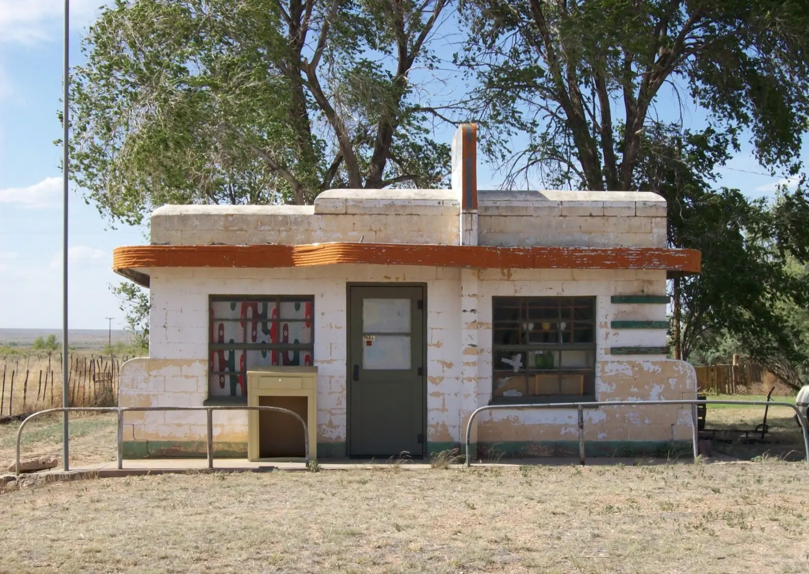
What you can see today: the 1950 Texaco station, the 1952 Little Juarez Cafe, the shell of the Longhorn Motel and its sign frame, and other buildings strung along a half mile of old road. The Glenrio Historic District was listed on the National Register of Historic Places in 2007. The one working business is a cannabis dispensary on the New Mexico side. Access: I-40 exit 0 in Texas puts you on the old road through town. The buildings are privately owned and several are unsafe, so walk the road, not the lots. My Texas stops guide covers the drive from Amarillo.
Route 66 ghost towns in New Mexico
Endee and Bard: on the gravel road west of Glenrio
Endee was founded around 1885 and took its name from the brand of the ND Ranch. In 1946 it had a grocery, a gas station advertising "modern restrooms," a garage, a school and a few cabins. Route 66 was rerouted around Endee in 1952, and its post office closed in 1955.
What you can see today: scattered ruins beside the old road. Access: this is the hard one. Endee and Bard sit on the original alignment from Glenrio to San Jon, about 17 miles of gravel, with a bridge condemned after a May 2023 flood and a dirt path through the creek bed instead. Skip it in a rental, an RV or after rain. The ruins are on private land.
Cuervo: cut in half by I-40
Cuervo, about 17 miles east-northeast of Santa Rosa, began with the railroad around 1901 and peaked with Route 66 traffic in the 1940s. Then I-40 was built straight through the middle of town. The post office closed on September 10, 2011.
What you can see today: a stone church, the shell of the old stone schoolhouse, and a lot of collapsing houses. A couple of homes are still lived in. Access: the Cuervo exit off I-40, then the frontage road, which is the old Route 66. The houses and church are private. My New Mexico stops guide has the rest of this stretch.
Route 66 ghost towns in Arizona
Two Guns: a tourist trap with a body count
Two Guns, on the east rim of Canyon Diablo about 25 miles west of Winslow, was never really a town. It was a roadside attraction, and a strange one. Earl and Louise Cundiff opened the Canyon Lodge here around 1924. In 1925 Harry "Indian" Miller arrived, claiming to be Apache (he was white, born in Roswell) and set up a zoo, a museum and a fake cliff dwelling. In 1926 Miller shot Cundiff dead and was acquitted on grounds of self-defense; the place took its name from Miller's nickname. Traffic dropped once the interstate arrived, and a fire destroyed the buildings in 1971.
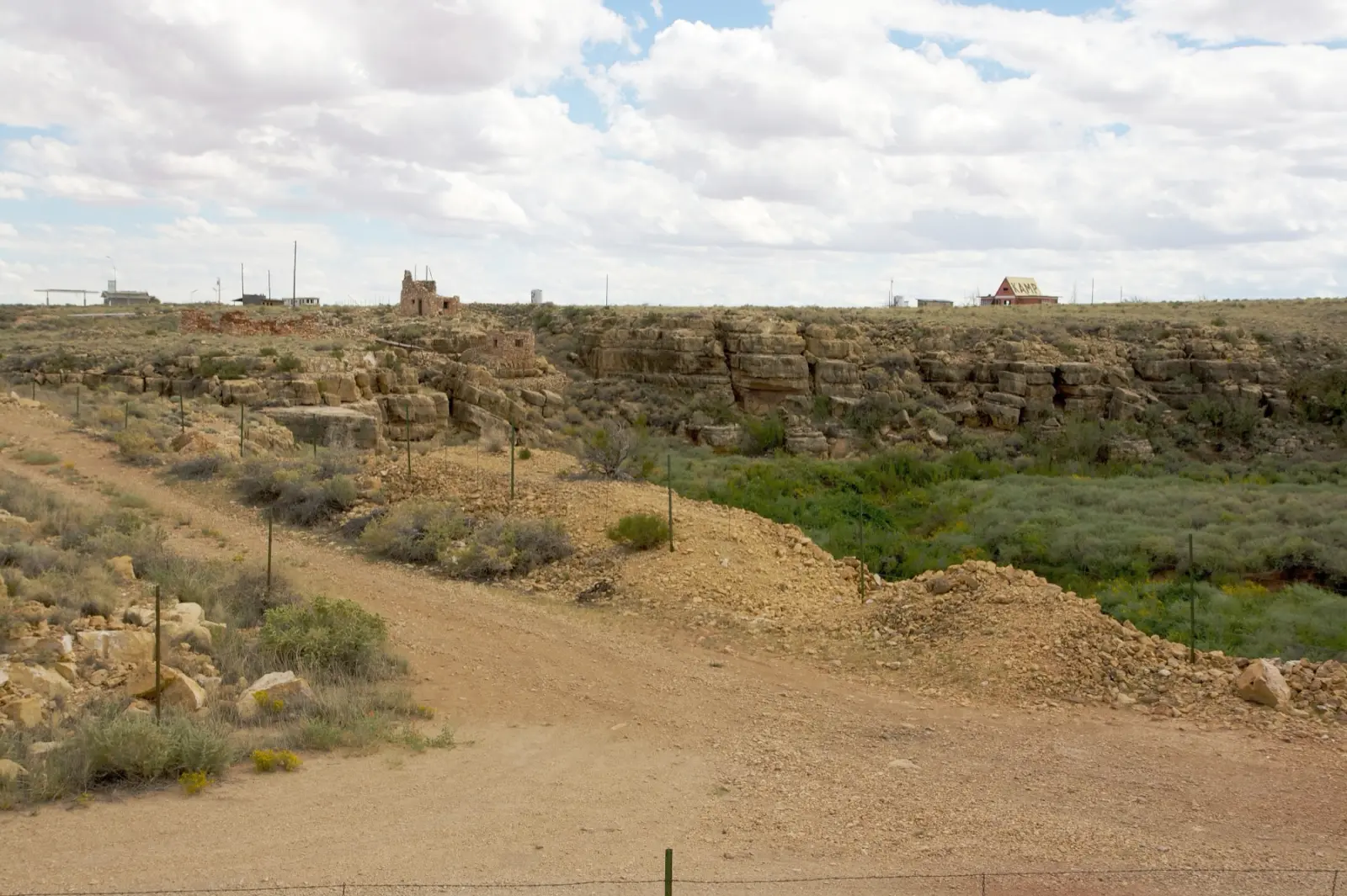
What you can see today: stone walls and fake ruins along the canyon rim, later gas station and campground shells, and the 1915 Canyon Diablo bridge. Access: I-40 exit 230. The site is private and the walls and canyon edge are unstable, so look from the edge of the road and respect any posted signs.
Twin Arrows: the trading post and its big arrows
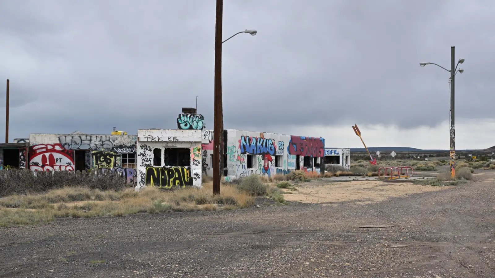
Twin Arrows, between Winslow and Flagstaff, began in the late 1940s as the Canyon Padre Trading Post. Business picked up when the owners renamed it, added a service station and planted two 25-foot arrows out front. The interstate killed the traffic, and it closed for good in 1995. The buildings belong to the Hopi Tribe. In February 2022 high winds brought one of the arrows down; one still stands.
What you can see today: the trading post and diner buildings, covered in graffiti, and the surviving arrow. Access: I-40 exit 219. The site is closed: photograph it from outside. For everything else between here and the California line, see my Arizona stops guide.
Hackberry: the town that almost died twice
Hackberry, 28 miles northeast of Kingman on State Route 66, was a silver mining town first. The mine opened in 1875 and closed in 1919. Route 66 brought it back in 1926. Then I-40 left it 16 miles from the new highway, and the last station closed in 1978.
What you can see today: the Hackberry General Store, reopened in 1992 by the artist Bob Waldmire in the old Northside Grocery, with old cars and gas pumps out front. The town around it is very quiet. Access: paved, on the 89-mile Seligman to Kingman stretch of State Route 66. The store is a business; the houses behind it are private.
Goldroad: razed on purpose in 1949
Goldroad sits on the switchbacks of the Oatman Road, between Sitgreaves Pass and Oatman. It grew around the Gold Road mine, and it didn't fade away: it was knocked down. In 1949 the mine's owner tore down the wooden buildings and wrecked the stone ones to stop paying property taxes on them. In 1953 Route 66 moved to a new line through Yucca.
What you can see today: foundations and stone ruins along the road. The Gold Road mine was reopened by a mining company in 2007, so the property around it is a working, private site. Access: paved but narrow, with hairpin curves. Vehicles over 40 feet are not allowed over the pass. Don't wander onto mine property.
Oatman: the living ghost town
Oatman is the ghost town that came back. A 1915 gold strike grew the camp to more than 3,500 people in a year. The main mine shut in 1924, and in 1941 the government closed the district's remaining gold mines for the war effort. Route 66 kept the town alive until 1953, when a new route between Kingman and Needles went around it, and by the 1960s Oatman was nearly abandoned. About 102 people lived there in 2020.
What you can see today: a Main Street of wooden sidewalks, gift shops, the 1902 Oatman Hotel (the oldest two-story adobe building in Mohave County) and wild burros, descendants of the miners' pack animals, walking among the cars. Access: the Bureau of Land Management calls the road from Kingman the Route 66 Oatman Road Back Country Byway, 42 miles of paved two-lane with steep grades, and recommends October through April. If the curves worry you or you're over 40 feet long, take I-40 toward Topock and drive up to Oatman from the west. My guide to safety on Route 66 covers the pass in more detail.
Route 66 ghost towns in California
The Mojave has the most ghost towns on the route: railroad water stops from the 1880s that Route 66 later followed, drained at once when I-40 opened to the north in 1973. Some of the road is closed, so read the access notes.
Essex: the town that went on The Tonight Show
Essex was known on Route 66 for free water, from a well put in by the Automobile Club of Southern California. It had no television reception until 1977, when Johnny Carson invited the residents, about 50 people, to a taping of The Tonight Show. The population was 111 in 2000 and an estimated 10 in 2013.
What you can see today: a few buildings along the railroad, a Caltrans yard, and dozens of abandoned homes. Access: difficult in 2026. As San Bernardino County described it at the end of June 2026, National Trails Highway from Kelbaker Road to Essex and from Essex to Mountain Springs Road was closed, and Essex Road between I-40 and the old road was closed to through traffic. Check the county's closure page before you go.
Amboy: zero residents, one open business
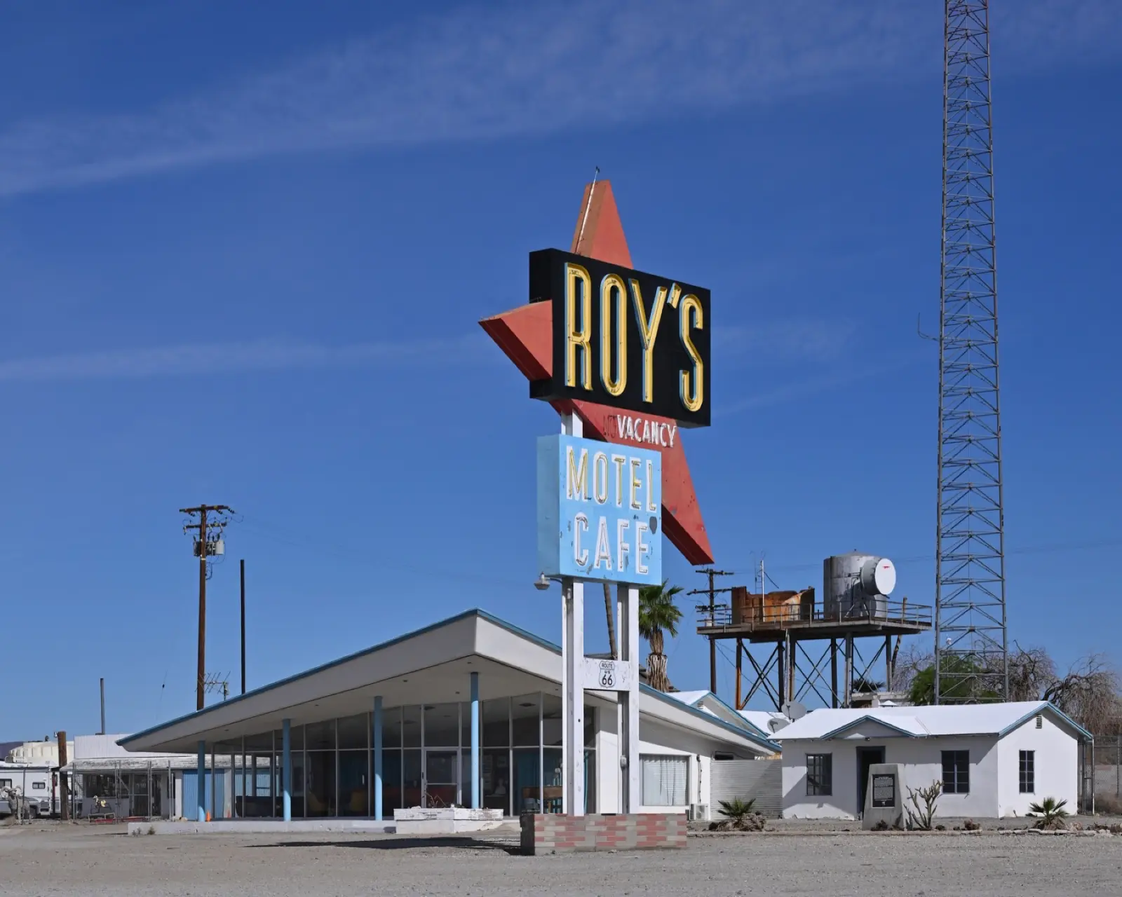
Amboy was founded in 1883 as the first of a series of railroad stops named in alphabetical order across the Mojave. Roy's Motel and Cafe opened in 1938 and its boomerang sign went up in 1959. After I-40 opened in 1973 the town shrank, and by 2024 the permanent population was zero.
What you can see today: Roy's and its sign, the old school (closed in 1999), and Amboy Crater just to the west, a cinder cone 250 feet high. In June 2026 Roy's was working as a gas station and souvenir shop, with no cafe service, and the motel rooms weren't open yet. The whole town is privately owned by the Okura family. Access: from I-40 at Kelbaker Road, drive south about 10 miles to the old road, then west. Barstow to Ludlow to Amboy was open in June 2026, with a bridge replacement project near Amboy expected to run until April 2027.
Bagdad and Siberia: nothing left but the names
Between Amboy and Ludlow, the old road passes the sites of Bagdad and Siberia. Both were railroad water stops that faded after 1973. Bagdad's remaining buildings were razed in 1991. It still holds the record for the longest dry spell in United States history: 767 days without rain, from October 3, 1912, to November 8, 1914. Siberia, just to the west, has been cleared too. The Bagdad Cafe of the 1987 movie is in Newberry Springs, much further west, not here.
What you can see today: almost nothing; at Bagdad, little more than the concrete pad of an old airway beacon. Access: on the open stretch of National Trails Highway between Amboy and Ludlow.
Ludlow: half ghost town, half truck stop
Ludlow was founded in 1882 as a water stop and boomed with nearby mines. From 1906 to 1940 it was the end of the Tonopah and Tidewater Railroad from Death Valley; after that it lived on Route 66 traffic. After I-40 went through, most residents left.
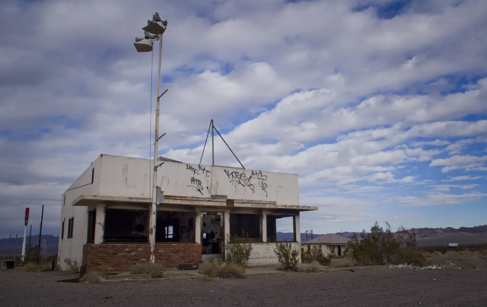
What you can see today: empty buildings and tamarisk trees along the old road east of the interstate, and right next to them, a working gas station, cafe and motel at the I-40 exit. Access: I-40 at Ludlow; Barstow to Ludlow on the old road reopened in December 2022. The ruins are private. My California stops guide has the full Mojave plan.
Route 66 ghost towns at a glance
| Town | State | Why it emptied | What's left | Access in 2026 |
|---|---|---|---|---|
| Times Beach | MO | Dioxin, evacuated 1983 | Nothing; now Route 66 State Park and visitor center | I-44 exits 265 and 266; public park |
| Spencer | MO | Bypassed 1961 | Station, store, barber shop and cafe, under restoration | Paved; private, view from road |
| Texola | OK | I-40, 1975 | Empty storefronts, 1930 Magnolia station, jail | I-40 exit 1; people live here |
| Glenrio | TX/NM | I-40, 1973 | Texaco, cafe, Longhorn Motel shell | I-40 exit 0; paved; private lots |
| Endee | NM | Rerouted 1952 | Scattered ruins | 17 miles of gravel, broken bridge; private |
| Cuervo | NM | Split by I-40 | Stone church, schoolhouse, empty houses | I-40 frontage road; a few residents |
| Two Guns | AZ | Interstate, fire 1971 | Stone ruins, 1915 bridge | I-40 exit 230; private, unstable |
| Twin Arrows | AZ | Interstate, closed 1995 | Trading post, one arrow | I-40 exit 219; closed site |
| Hackberry | AZ | Mine closed 1919, I-40 bypass | General Store (open), quiet town | Paved, State Route 66 |
| Goldroad | AZ | Razed 1949, road moved 1953 | Foundations, working mine | Oatman Road, 40-foot limit; private |
| Oatman | AZ | Mines shut, bypassed 1953 | Living town, hotel, burros | Oatman Road or from Topock |
| Essex | CA | I-40, 1973 | A few buildings, abandoned homes | Roads closed in mid-2026 |
| Amboy | CA | I-40, 1973 | Roy's (gas, souvenirs), school, crater nearby | Via Kelbaker Road; open |
| Bagdad, Siberia | CA | I-40, 1973 | Almost nothing | Open road, Amboy to Ludlow |
| Ludlow | CA | I-40 | Ruins plus a working gas stop | I-40; open from Barstow |
How to visit Route 66 ghost towns safely and legally
- Assume it's private. Almost every building here has an owner, even when it looks abandoned. Photograph from the road.
- Don't go inside. Roofs and floors are decades past their life.
- Take nothing. A brick from Glenrio is a piece of a National Register district.
- Fill up before the empty stretches. In the Mojave, fuel up in Needles or Barstow; Roy's is a backup, not a plan.
- Check the closures. The two that matter in 2026 are the gravel between Glenrio and San Jon and the closed sections of National Trails Highway around Essex.
- Go in daylight. None of these places has lights.
If you want to fit several of these into a trip, the free planner at route66operator.com gives miles, hours and costs between 56 towns on the route, and my history of Route 66 explains why the interstates were routed the way they were.
Which Route 66 ghost town is most worth the stop?
If you have time for only a few: Glenrio, right off I-40, which you can see from the old road in fifteen minutes; Twin Arrows for the truly empty kind; Oatman for the drive over Sitgreaves Pass; and Amboy if the road from Kelbaker is open the week you go.